Correction to "Drown Your Town" map for Island Park
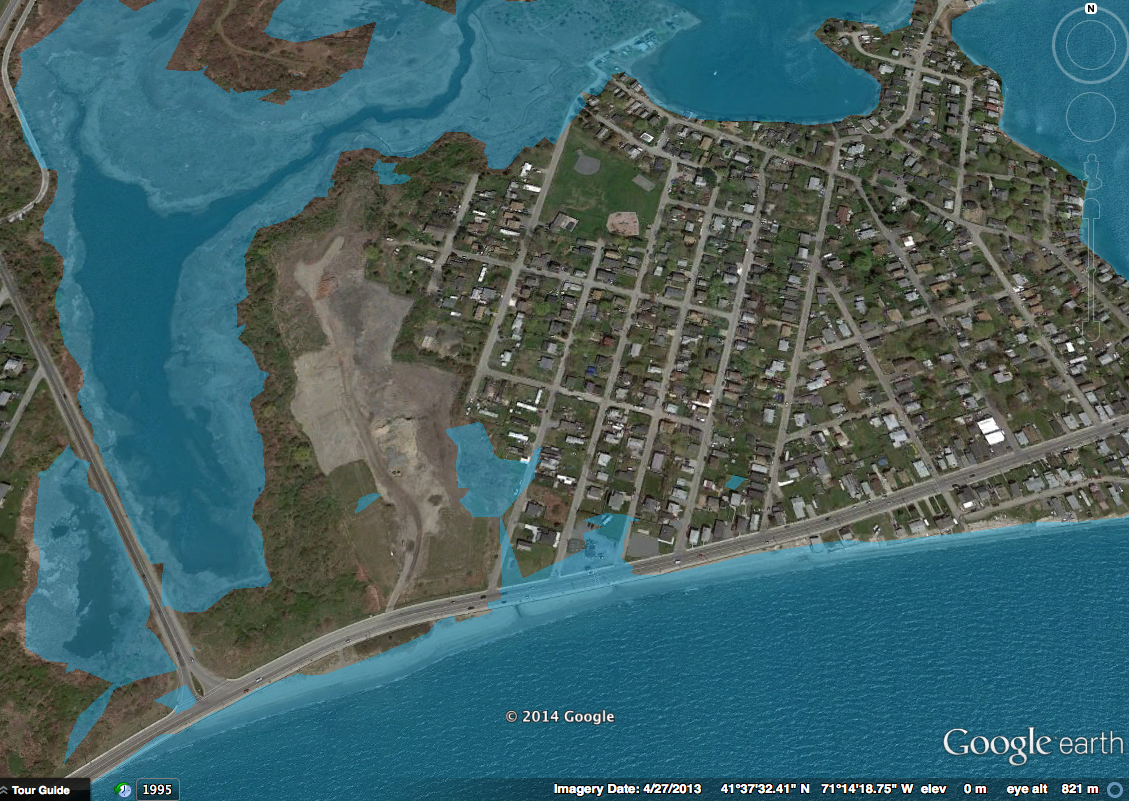 |
| Click to embiggen. |
In an article in the Portsmouth Times this week, a map I had created in Google Earth of Island Park with a 1-meter sea level rise appeared to show more potential flooding because of the resolution of the map (technically, the eye height from which the image was snapped.) While this was unintentional, I apologize for any confusion and anxiety this may have produced.
I've attached a new map, which uses the outside estimate of year 2100 rise from the EPA, shot from a much lower altitude to improve resolution, and it clearly shows that even at 1.4 meters of sea level rise, there would still, technically, be a connection between Island Park and the rest of Aquidneck Island.
I received an e-mail from one of Portsmouth's public officials complaining about the inaccuracy, so I wanted to set the record straight. The map was incorrect. I have heard that the Planning Department is in the process of drawing up official maps for various sea level rise scenarios as part of the Natural Hazard Mitigations Plan update, and I would urge all my neighbors here in the Park to study those when available.
Again, my apologies for this error.